THIS ARTICLE/PRESS RELEASE IS PAID FOR AND PRESENTED BY the Institute of Marine Research - read more
Satellite-tagged bluefin tuna swam 15,000 kilometres in a year
…and ended up at the same spot, at the same time where the scientists had tagged it the previous year.
“It’s amazing. We never expected the tag to release just 15 kilometres from where we caught the fish a year ago,” says marine scientist Keno Ferter.
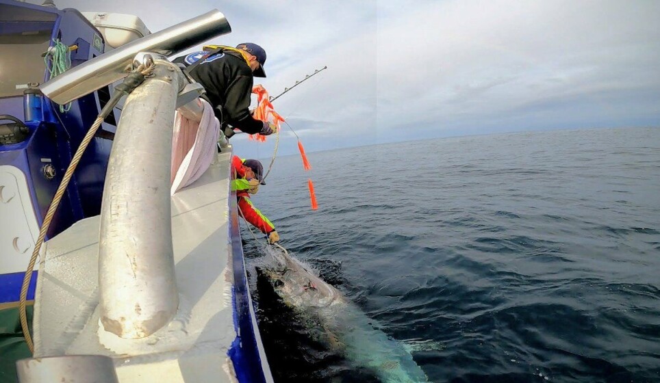
September 2020: Researchers attach a satellite tag to the back of a 250-kg bluefin tuna off Florø. This is one of the northernmost taggings of the world’s biggest tuna species.
Crossed the North Atlantic in a month
The satellite tag is programmed to collect data for precisely a year before releasing, floating to the surface and transmitting data to base by e-mail. The researchers are keen to find the tag itself as well, as it contains even more data, which will help them to learn as much as possible about the distribution and migrations of this huge fish.
“And what a journey this fish has been on! Initial analysis suggests it has swum over 15,000 kilometres measured as the crow flies, as well as doing some impressive dives down to almost one thousand metres. Each day, it has also spent time close to the surface,” says Ferter.
From Florø, the bluefin tuna travelled west past Shetland and almost to Canada, back east into the Mediterranean, then north past Ireland and Shetland up into the Norwegian Sea west of Brønnøysund, and finally back south to Florø. Phew.
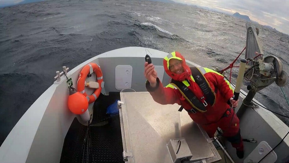
This year’s tagging programme is underway. Watch a video of that and of the moment when researchers found a satellite tag from last year: (Media? Feel free to use our photos and videos. Embed our movie or click here to go to a download folder with more photos and video without graphics.)
Appear to have a good sense of direction – and to remember where the dinner lives
The bluefin tuna population has recovered from past overfishing. Once again, large schools of this enormous fish swim up the Norwegian Sea in summer to feed. It was therefore not improbable that the tag would reappear in Norwegian waters.
“Somewhere along the Norwegian coast was what we expected, but not the exact same spot,” says Keno Ferter, who is leading the tagging project.
His colleague Leif Nøttestad, who is the person at the Institute of Marine Research (IMR) responsible for the bluefin tuna stock, is really pleased to have the new data.
“This data suggests bluefin tuna have a great homing ability – in other words they are able to find their way back to good feeding grounds year after year,” he says.
Satellite tag data provides unique insight
In the 1950s and 60s, the weight of bluefin tuna coming to Norway increased by a few tens of kilos from one year to the next. This also indicated that the same fish returned time and again to feed in our rich waters,” says Nøttestad.
He explains that the satellite tag data is very valuable for research on this species. This is because it can tell us about unknown spawning and feeding grounds, and about how long the bluefin tuna stays in different areas.
“How much time the fish spend near the surface as opposed to in deep water can help us to estimate how many bluefin tuna there are in Norwegian waters – we use observations at the surface and sonar images to do this,” explains Leif Nøttestad.
“The technology has enormous potential. Bearing in mind that we’ve got such good data from a single fish in Norwegian waters, just imagine what we could learn from more individuals over a number of consecutive years,” says Nøttestad.
Expect more data about the bluefin tuna’s secrets
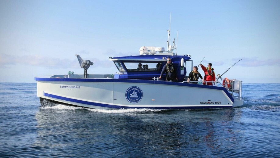
Norwegian researchers tagged five bluefin tuna last year, and they are currently doing this year’s tagging. They have found an effective and gentle tagging method.
“We have recovered three of last year’s tags. Each of these contains a whole year’s worth of data, with over 6 million data points, which we will now analyse and publish in scientific papers as soon as possible,” explains Ferter.
“This year’s season has been a success, and we are looking forward to further exciting migratory routes being revealed in the coming years,” says Keno Ferter.
The satellite tags are part of a major international tagging project (ICCAT-GBYP), which is financed by the EU, The International Commission for the Conservation of Atlantic Tunas (ICCAT) and other institutions including the IMR. ICCAT uses its research to promote sustainable management of the previously threatened species.

See more content from the Institute of Marine Research:
-
Do whales compete with fishermen?
-
These whales have summer jobs as ocean fertilisers
-
Have researchers found the world’s first bamboo coral reef?
-
Herring suffered collective memory loss and forgot about their spawning ground
-
Researchers found 1,580 different bacteria in Bergen's sewage. They are all resistant to antibiotics
-
For the first time, marine researchers have remotely controlled an unmanned vessel from the control room in Bergen


