THIS CONTENT IS BROUGHT TO YOU BY the University of Bergen - read more

What can ancient island moraines reveal about climate change?
“Human impact is a dominant factor,” researcher says.
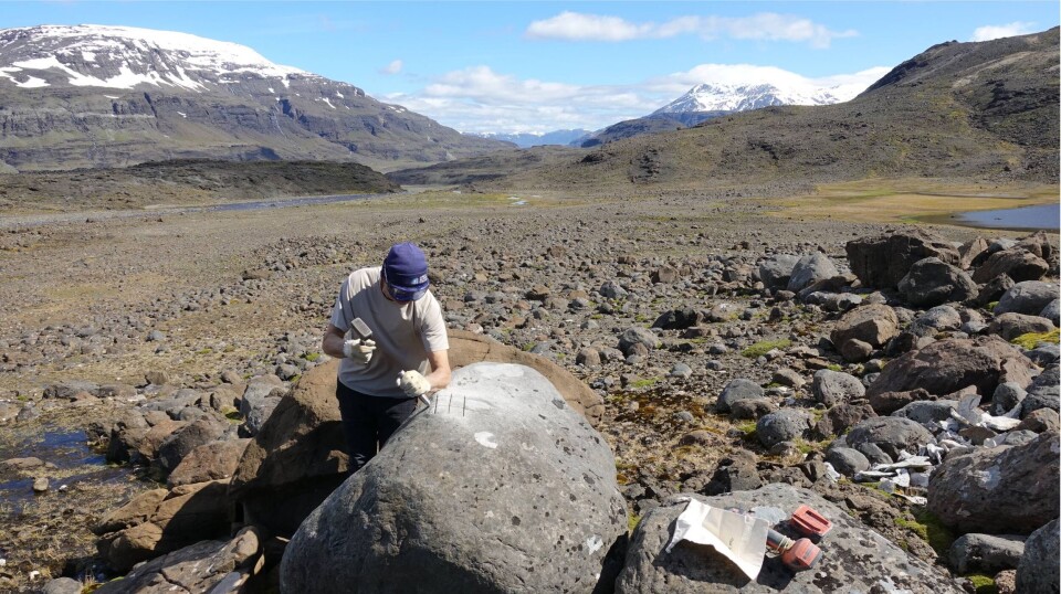
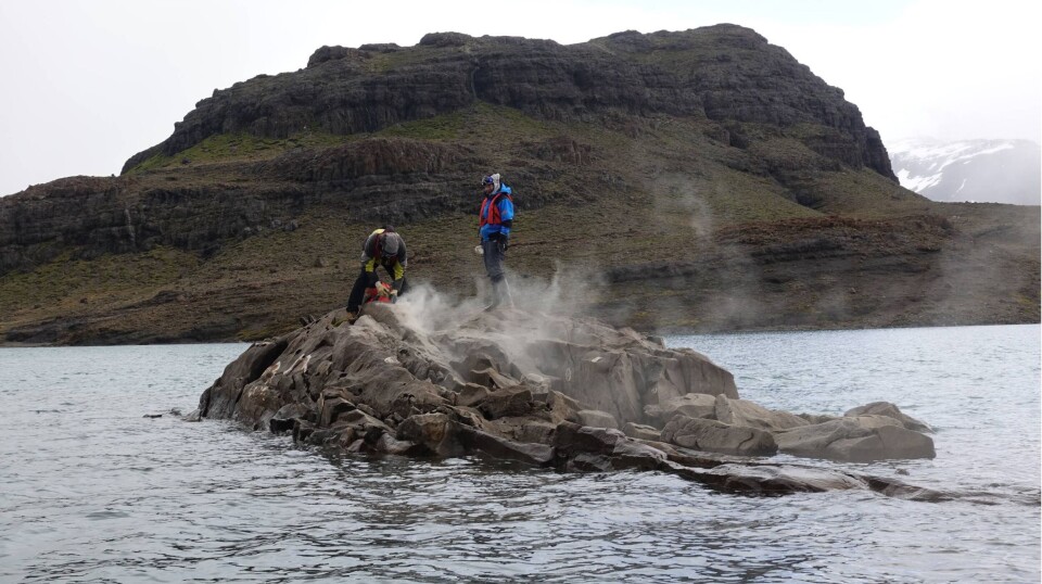
The Earth's surface is constantly exposed to cosmic radiation from space, leading to changes in the atoms on the surface. By measuring the concentration of these atoms in a rock surface, scientists can calculate how long the area has been ice-free.
Mountain peaks became ice-free about 13,500 years ago
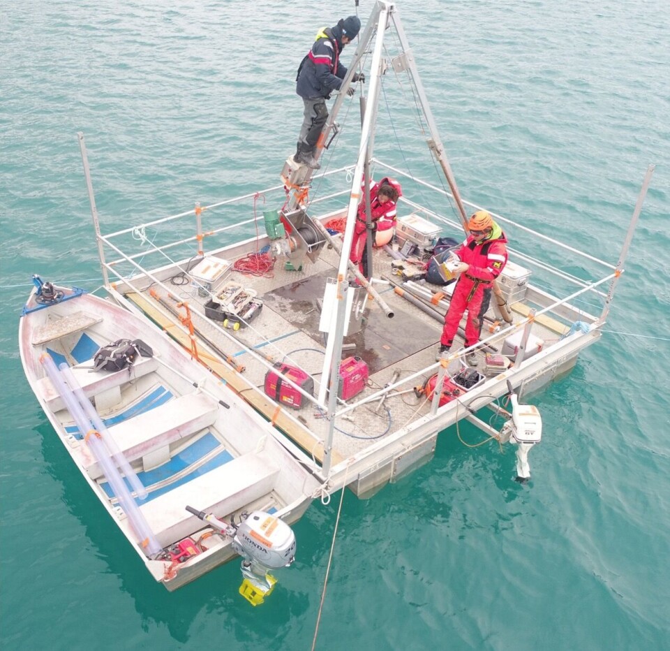
In 2019, an international research team travelled to Kerguelen, a group of islands in the southern Indian Ocean, to perform lake coring, where they extract sections of sediment layers from the bottom of a lake. This allows scientists to study the historical and environmental conditions of the lake over time.
“My research is dating glacier landforms, glacial moraines in particular. Mapping out the moraines gives us an idea of how big glaciers where in the past. When we date the moraines, it allows us to reconstruct past glaciers both spatially and temporally,” says Talin Tuestad.
She is a PhD candidate at the University of Bergen’s Department of Earth Science, and is the first author in an article recently published in Quaternary Science Reviews.

The oldest moraines they found on Kerguelen are about 11,500 years old, but dating results show that mountain peaks in the area started becoming ice-free around 13,500 years ago. This means they have made discoveries dating from the end of the last glacial period and into the Holocene, the current geological epoch.
Early Holocene moraines discovered on Kerguelen
“The key discovery is that we found early Holocene moraines in Kerguelen, dating from 11,500 to 10,400 years ago. These are the first moraines of that age to be found on the island,” says Tuestad.
Previously, researchers had only identified several moraines from the late glacial period, approximately 13,000 to 14,000 years ago, from a time known as The Antarctic Cold Reversal. These moraines show that glaciers on Kerguelen advanced during this period and then retreated during a relatively warm early Holocene.
“Until now, no one has found any moraines from the early Holocene; they just assumed that glaciers retreated to very small extents during this time. Our results show that at least one glacier was still relatively big in the early Holocene,” she says.

Sediments sampled from lake floors can also indicate when glaciers developed or disappeared, as well as the temperature at different times. All these variables can be linked to the westerlies, which are the prevailing winds from the west towards the east in the middle latitudes.
Jarle Børve Sleire is analysing sediment from lakes on Kerguelen. These sediments are extracted from lakes that receive input from glaciers. The glaciers grind down the bedrock, creating rock flour – a fine sediment that is transported by rivers and deposited in the lakes.
“Using sediment cores, we can date and reconstruct how these glaciers behaved in the past. My work focuses on analysing sediments from the last 1,000 to 2,000 years to identify how the glacier has behaved,” says Sleire. He is also a PhD candidate at the University of Bergen’s Department of Earth Science.
How glaciers reflect climate change
Glaciers works as climate indicators. They can warn us about future changes. By studying their behaviour over time, we can gain insights into how the climate has changed.
“For instance, glaciers on Kerguelen can tell us a lot about how the southern westerly winds have varied in the past. Similar to how Bergen receives rainfall from the northern westerly winds, we have a comparable situation in the Southern Hemisphere,” says Sleire.
In the Southern Hemisphere, the southern westerlies move around Antarctica, supplying precipitation to islands like Kerguelen. Without this supply, glaciers could not exist.
“Today, the westerlies are shifting further south, and we can see this in the glaciers as they are rapidly retreating,” he says.
Human impact is a dominant factor
Other mid-latitude areas, such as parts of Australia and New Zealand, have also been affected, with droughts becoming more common in recent decades.
“My data, as well as the research of others, indicate that the westerly winds have varied substantially in the past, but the current situation is exceptionally unusual,” says Sleire.
He explains that previous changes in the westerlies were connected to natural cycles and feedback in the climate system. Now, human influence and global warming seem to be the dominant factors affecting the wind belt’s behaviour. Rising temperatures are not only melting Kerguelen’s glaciers but also depriving them of snow, hail, and rain.
The southern westerly winds impact both climate on land and the Antarctic Circumpolar Current, which is essential for carbon uptake in the Southern Ocean. More research on this is crucial.
Sleire finds working with this material interesting, especially when he gains control over the age of sediments and can create reconstructions. He finds it rewarding to achieve age control and see everything fall into place, allowing him to compare his data with that of other researchers.
Reference:
Talin Tuestad et al. Late Glacial-Holocene cirque glacier chronology on sub-Antarctic Kerguelen Archipelago (49°S) based on cosmogenic 36Cl exposure dating, Quaternary Science Reviews, 2024. DOI: 10.1016/j.quascirev.2024.108754

This content is paid for and presented by the University of Bergen
This content is created by the University of Bergen's communication staff, who use this platform to communicate science and share results from research with the public. The University of Bergen is one of more than 80 owners of ScienceNorway.no. Read more here.
More content from the University of Bergen:
-
Is political polarisation dangerous? A new study provides clearer answers
-
The oldest water in the Arctic Ocean has been there for several hundred years
-
Researcher discovered that migrants lived more stable lives in the USA than in Norway
-
A brutal field trip gave researchers new insight into Arctic winters
-
Your rain gauge could help improve weather forecasts
-
How one genetic error can affect both the heart and the brain


