An article from NIVA - Norwegian Institute for Water Research
Kon Tiki 2 sets sail
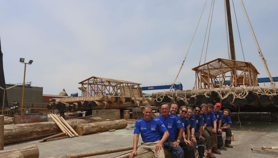
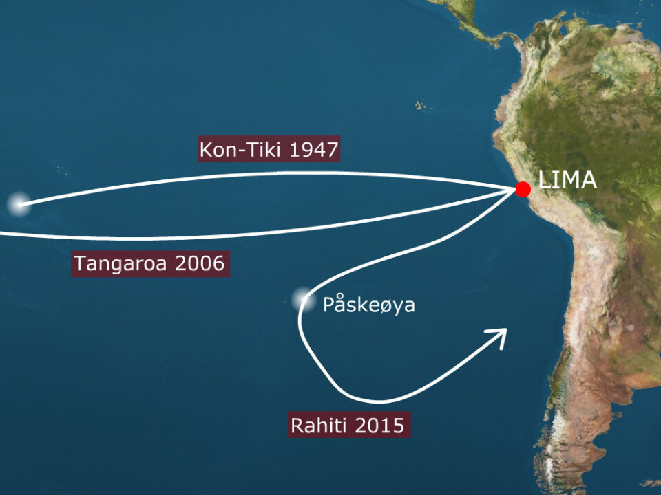
Two balsa rafts have sailed from Lima, Peru for the Easter Island. In six weeks the expedition will return after a trip of more than 5000 nautical miles. The rafts are equipped for full scale oceanographic research and the first attempt in our time to show how ancient mariners sailed the Pacifics.
Denne artikkelen er over ti år gammel og kan inneholde utdatert informasjon.
The expedition follows Thor Heyerdahl's famous footsteps showing the world that a maritime culture at least a thousand years existed along the South Americans west coast.
Today, scientists know a lot more about raft sailing and where these rafts were used for. The oldest fleet voyages were probably from Peru, and already containing relatively advanced constructions to steer the rafts. Returning from Polynesia to Peru on ancient rafts has not been done in modern times, but that is what the “Kon-Tiki 2” expedition plans to do. This way genetic data showing that the ancient mariners in prehistoric times could sail both ways over the world's oceans will be confirmed.
Unique opportunities
The expedition provides unique opportunities for environmental monitoring and sampling. Partners in the research project consists - besides the expedition team led by Torgeir Higraff and research director Cecilie Mauritzen – of the Norwegian Institute for Water Research (NIVA), Kongsberg Maritime and Norwegian University of Science and Technology (NTNU). In addition, a number of sponsors’ decisive contribution to the expedition, including Opera Software who will secure on-line data transfer from the rafts.
The rafts will function as excellent research platforms, Mauritzen says.
- They will sail in a remote part of the world oceans, so that any data we gather will be very valuable. They will sail very slowly compared to a regular research vessel, so the data we collect will have high resolution (i.e. more and closer together measurements can be made than what is common).
Give the ocean a voice
The path takes the expedition through one of the large garbage accumulation zones of the world oceans (so-called “gyres”), so high-tech and low-tech instrumentation will be brought along to identify and quantify macro- and micro plastics. Simultaneously changes in ocean acidification, in oxygen content, in marine life, in pollution, and in ocean heat content will be monitored.
- The oceans are undergoing large changes as a consequence of human interventions, Mauritzen says.
- We hope that by being out there, observing these changes, on the old-style sailing vessels of the ancient peoples of the South Pacific, we can put international focus on the deteriorating state of the world oceans just as the top leaders of the world are sitting down in Paris to try to formulate a new climate agreement. The ocean is a huge, stateless, voiceless partner in those negotiations. Hopefully, we can give it a voice.
Through the gyre
NIVA, in collaboration with NTNU and Kongsberg Maritim, will take this unique opportunity to perform a variety of marine environmental studies in the remote area in the Pacific Ocean covered by the expedition. The research program on the expedition is funded by the Ministry of Foreign Affairs.
These projects not only include climate and water quality measurements but also the measurement of micro plastic and the environmental pollutants regulated by UNEPs Stockholm convention associated with the plastics.
The part of the Pacific covered by the Kon Tiki 2 expedition has been identified as one of the 5 accumulation zones for marine liter (one of the 5 so called ‘gyres’). Only limited information is known on the composition of the litter, the seize distribution or the association with the pollutants on UNEPs Stockholm convention.
High-tech ancient raft
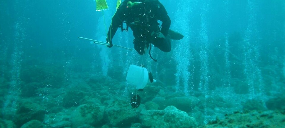
Marine litter will be sampled during the crossing by using a Manta Trawl sampling macro and micro plastics larger than 300μm. In addition a newly developed stationary 3 stage pump sampler will be used to study the seize distribution in the so called Eastern Pacific gyre which will be cross during the crossing. No seize distribution data of any of the 5 gyres has ever been measured.
- Being part of the Kontiki 2 expedition is a unique possibility to get more data on the composition of the Southern Pacific gyre. With new instrumentation we will be able to study not only the seize distribution but also identify the sort of plastics or polymer materials. This will give us new insight on behavior of micro plastic as well as source identification , Research manager Bert van Bavel says.
- We will also study the role of plastics in the distribution and transport of persistent organic pollutants, these pollutants move from the water phase to the plastics and this makes these pollutants more mobile and more assessable for wildlife.
On ‘raft’ identification of the macro and micro plastics (down to 1 mm) from the trawl or the 3.stage sampler will be done by using micro NIR equipment directly connected to the USB port of a lab top, these NIR spectra will be analyzed on-line by NIVA. Filter samples from the 3 stage pump sampler down to 50 μm will be stored for further analysis by high resolution NIR in the laboratory. These samples will also be analyzed for the persistent organic pollutants (POPs) regulated by the Stockholm convention. One of the research objectives here is to establish the role of micro plastics in the transport of these compounds bound to micro or macro plastics in remote areas.
Indicating climate change
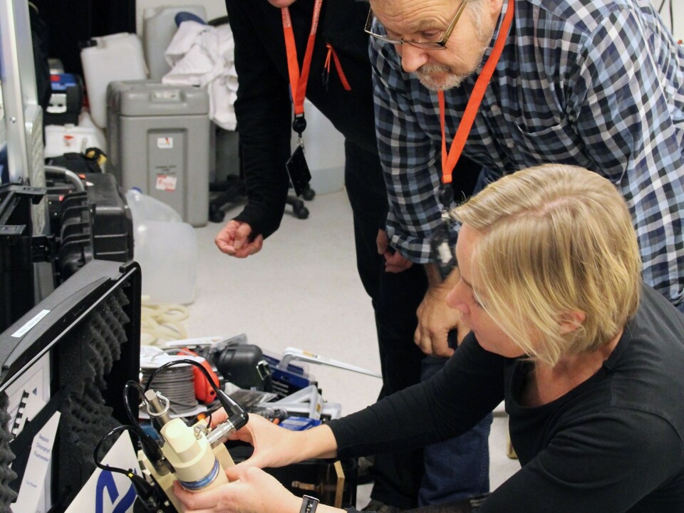
NIVA will also provide sensors (CTD) for Deep Sea measurement of temperature, salinity, oxygen and Chlorophyll-A fluorescence as a proxy for the phytoplankton, in addition to installing similar sensors for continuously monitoring of surface water. Additional sensor for studying the carbon system variables will be implemented to give the scientists direct insight into the most direct indicators of climate change in the ocean. This involves a state-of-the art-Ferrybox pCO2 system constructed by Franatech and NIVA, and NIVA new pH sensor and a pH sensor supported by NTNU. These measurements will be supported by water sampling and analysis of essential variables for studying phytoplankton in collaboration with NTNU.
The measurements from NIVA and NTNU will later be used together with available remote sensing data for “ocean colour” to give us a complete and quantitative insight into the condition of the oceans along the path of “Kon-Tiki 2”.
-------------------------------------
Read the Norwegian version of this article at forskning.no