An article from NIVA - Norwegian Institute for Water Research
Locating hazardous substances
Large areas of the seabed in a Norwegian fjordsystem are polluted with hazardous substances. To remedy this, researchers have developed models that point out the worst patches of the seabed.
Denne artikkelen er over ti år gammel og kan inneholde utdatert informasjon.
“Remedial measures should be aimed at areas that contribute most to the spreading of the pollution,” says researcher Trine Bekkby at the Norwegian Institute for Water Research (NIVA).
She and her colleagues have developed models that identify the terrain in the bottom areas containing the largest quantities of toxin-linked particles in this south Norwegian branch of fjords. Knowledge of the terrain is of essence for the decision on whether or not - and potentially where - to cover the polluted areas with clean mud.
The areas with hazardous substances are too extensive to be wholly covered by clean mud or isolated, as has been done in other spots.
Bekkby points out the importance of understanding the pollution situation at various depths and different areas of the fjord, and their impact on the spread of such toxins.
One of Norway’s most polluted fjord systems
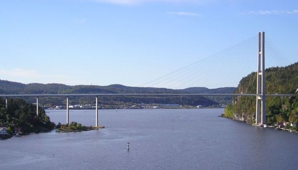
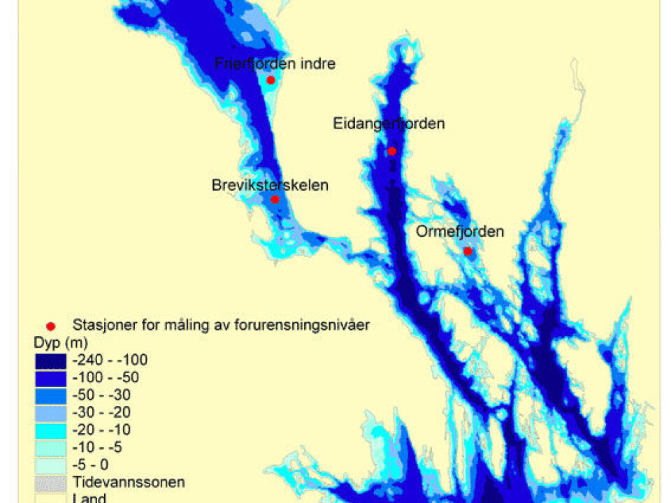
The pollution of bottom mud in the Grenland fjords comes from various types of industry and activities around these waters. But former discharges of chlorated organic compounds from the Norsk Hydro magnesium plant at Herøya dominate the pollution scene here.
Even though the factory was shut down in 2002, the toxins can still be traced far out in the fjord system.
“We are particularly worried about the concentrations of dioxins and furans in the sediments”, says Marianne Olsen, project leader at the County Governor of Telemark.
Dioxins and furans are two groups of hazardous substances that share many similar qualities. Concentrations in the Grenland fjords qualify them for a rating of “very poor condition” within the guidelines of the Climate and Pollution Agency (Klif).
The polluted area encompasses many tens of square kilometres.
Bottom-dwelling messengers
“The Norwegian Food Safety Authority has advised against consumption of certain species of fish and shellfish from the Grenland fjords because of their content of hazardous substances. Before we can recommend remedial options in such a large area we need to gain an understanding of what is feasible and which effects we can realistically expect to achieve,” says Olsen.
Probably the major reason why the concentrations of hazardous substances in fish and shellfish are still high in this fjord system is that the poisonous substances are accumulated by bottom-dwelling organisms in polluted mud and are carried up through the food chain.
The toxins in question are linked to small particles that remain in the waters for a long time, and can thus be transported far with currents, before sinking to the bottom. This has enabled the hazardous substances to spread to almost the entire fjord system.
It’s likely that the highest concentrations of hazardous substances are in places where the most of these small particles collect.
“We’ve developed models that lead us to such areas,” says Trine Bekkby.
Cleaning up polluted seabeds
Environmental authorities have designated clean-ups of polluted seabeds as a priority area.
One solution under consideration for the Grenland fjords involves covering the worst polluted parts of the ocean floor with a thin layer of pure sand and gravel to limit leaching and absorption of hazardous substances in bottom organisms.
However, the polluted area of the Grenland fjords is so extensive that a traditional dredging and coverage operation is impractical. Covering with a thin layer of material seems to be the only realistic alternative to waiting for a slow natural improvement.
So it’s important to determine the location of large areas suitable for such coverage and estimate the amalgamated effect of countermeasures.
Identifying the most polluted areas
“-Our approach has been to identify the parts of the fjord system with a high probability of containing soft bottoms in various classes of depths, slopes and wave exposures”, says Bekkby.
As part of the modelling work in this project, the researchers have focused on depths, slopes and wave exposure. “We are especially interested in modelling probable sites of so-called accumulation basins, where we find the softest sediments,” Bekkby says.
“We’ve developed a methodology for digitally modelling probable occurrences of species, types of nature and biodiversity,” she explains.
This methodology is also used in the National Programme for Mapping and Monitoring Marine Biodiversity, a programme that has been ongoing since 2003.
Basis for decisions
The results of this modelling work will enter into decision-making process for the clean-up of the Grenland fjords.
“We’ve come a long way when we know what’s possible to implement, where initiatives can and should be targeted and what results we can expect,” says Marianne Olsen.
“We also want a better understanding of conflicts or negative consequences that prospective countermeasures could trigger. The presence of special types of nature, the public’s use of the area and commercial interests such as fisheries and harbour activities could conflict with remedial actions or with any prospective restrictions that such actions might entail.”
“A decision to act must be based on the comprehension of all these factors as well as a cost-effect analysis,” says Olsen.
“Models like the one we developed for this project can be very useful for planning remedial actions and resource management,” says Bekkby.
--------------------------------------------------------


