An article from Norwegian SciTech News at NTNU

Earth’s history reveals where earthquakes hit
How and why do movements of the Earth’s crust still cause death and destruction millions of years after they first happened? A new technique sheds light on this question.
The world map has not always looked the way it does today. Continents slide apart and collide, and vast mountain ranges jut upward and disappear.
These movements in the earth’s crust can be several hundred million years old, but their consequences affect us directly today – from earthquakes to oil discoveries.
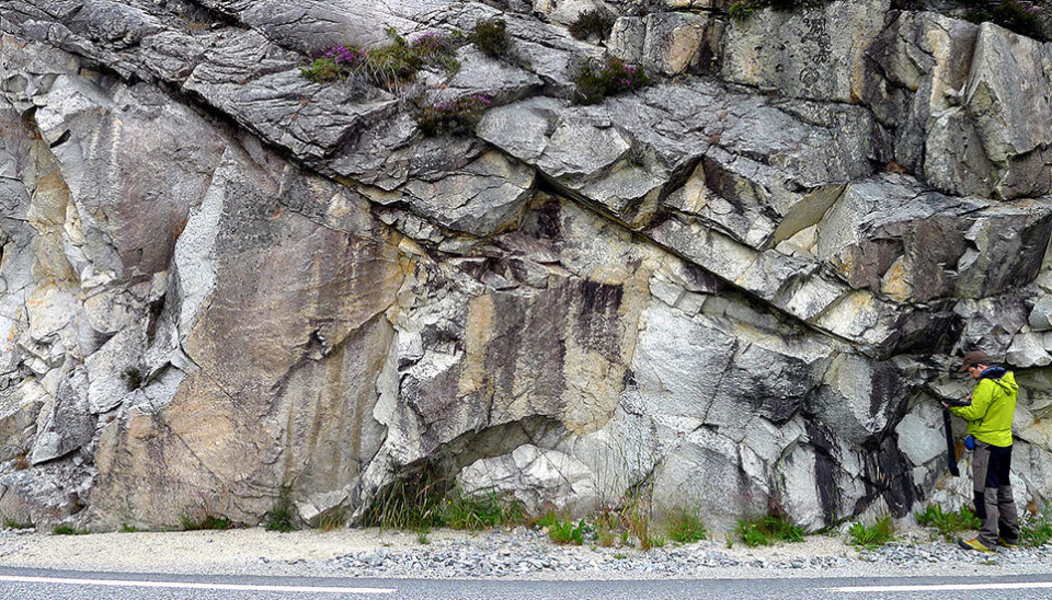
Now Norwegian researchers have come up with a new method to date when tectonic shifts first occurred. The researchers examined 400 square metres of the Goddo Fault in Bømlo municipality in Hordaland county.
This area tells the story of the breakup of the Atlantic Ocean, when North America and Greenland began to drift away from Europe around 250 million years ago. The site also reveals the further geological developments that laid the groundwork for the Norwegian oil fairytale and the landscape that we observe today.
Earthquakes triggered in weak areas
When two parts of the Earth’s crust move in relation to each other, the layers of rock accommodate this movement by deformation.
If the movement occurs deep down, where the crust is warm, soft and malleable, the crust folds like bread dough. At shallower depths where the crust is colder, the movement deforms the rock by forming brittle faults. If the mountain is then subjected to large enough stresses, it’s like breaking a cracker.
Brittle fault zones are very common, but little research has been done on them, despite the fact that they affect processes with dramatic consequences. When the tension builds up in a fault zone and becomes too great, a break in the fault occurs that in turn triggers an earthquake.
“Brittle faulting accommodates momentous and potentially dangerous deformation in the crust. The recent earthquakes in Italy and New Zealand are examples of longitudinal deformation with brittle faulting. Brittle faulting controls processes like earthquakes, but also groundwater, mineral and oil deposits,” says Giulio Viola, who until recently was a geologist for the Geological Survey of Norway (NGU) and an adjunct professor in NTNU’s Department of Geology and Mineral Resources Engineering.
An indication of important geologic event
Viola is the first author of a scientific article that has just been published in the prestigious journal Nature Communications.
The article describes a new method that allows a better understanding of brittle fault zones. The method combines detailed measurements of the fault geometry with dating of illitic clays, formed during brittle faulting.
For the first time, this approach makes it possible to account for when the different parts of a fault zone formed, as well as the complex internal architecture of the fault zone.
The Goddo Fault studied by the researchers formed in the Permian approximately 260 million years ago. It was reactivated with new movement 60 million years later, in the Jurassic. The researchers also found a phase of circulating fluids along the fault in the Early Cretaceous, approximately 125 million years ago. This event can be linked to the geological development of the Mid-Norwegian shelf, continental drift and mountain movements during this time.
“All these periods reflect the fracturing of the supercontinent that existed 250 million years ago. The Goddo Fault is representative of a very important geological event. It also reveals important geological history of the North Sea, and can help us better understand offshore environments,” says Hans Ola Fredin, who is a geologist at NGU and an adjunct professor in NTNU’s Department of Geography.
Can’t predict earthquakes
California is particularly vulnerable to earthquakes because the state is situated where the Pacific plate and the North American continental plate meet. Historically, several major earthquakes have been triggered on the famous San Andreas Fault southeast of Los Angeles.
Turkey is also located where several continental plates meet, and two different faults run through the country. The North Anatolian fault, which cuts right through Istanbul, is both powerful and extremely active, and is therefore considered the more dangerous one.
Scientists have long predicted that the faults in both California and Turkey will trigger new, large and destructive earthquakes in the future, but even though they are confident that it will happen, they cannot predict when the events will occur.
“We’re a long way from being able to predict earthquakes. We can pinpoint what’s happened when, but we can’t see into the future,” says Fredin.
International research collaboration
The research presented in the paper is part of the BASE project, a four-year multidisciplinary research program at NGU. The researchers are also affiliated with NTNU, University of Tromsø and Sogn og Fjordane University College, in addition to collaborative partnerships that have been established with universities in Italy, Australia and Japan.
As part of the BASE project, NGU has built a new laboratory for characterization and dating of illite clay.


