THIS CONTENT IS BROUGHT TO YOU BY Nord University - read more
AI sparked an idea that could improve road safety in Norway
A university student’s innovative approach to mapping road hazards – inspired by self-driving technology – could contribute to making Norwegian roads safer.
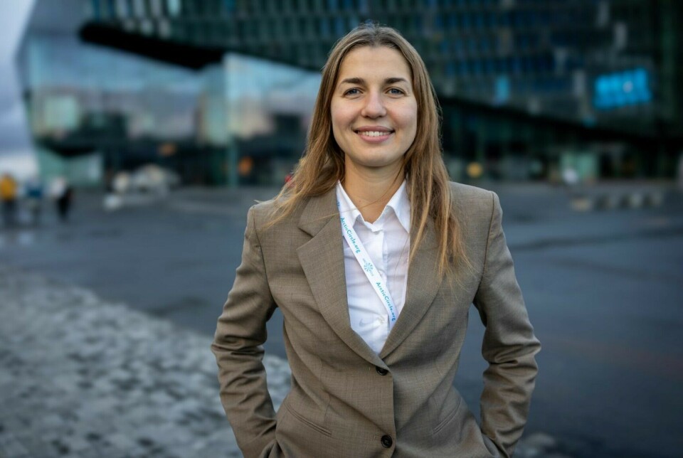
It all began with a decision Anastasiia Kolesnikova had to make during her third semester as a master's student in Global Management at Nord University's Business School.
Instead of just learning from books, the students worked on real projects aimed at improving cities in the north.
These opportunities arose through the EduSmart project.
Working with self-driving buses
This initiative is based at the High North Center at Nord University. There, students were challenged to think innovatively about technological solutions for northern communities.
For Kolesnikova, this meant working on something groundbreaking: the world's northernmost self-driving buses, in collaboration with Nordland County Municipality.

“It was incredibly exciting to work on a project with such cutting-edge technology. We had two self-driving buses in Bodø, the northernmost route in the world for such vehicles," she says.
Kolesnikova was inspired. She observed how the self-driving buses used advanced technology to map and understand their surroundings.
This sparked an idea.
Mapped road systems by bike
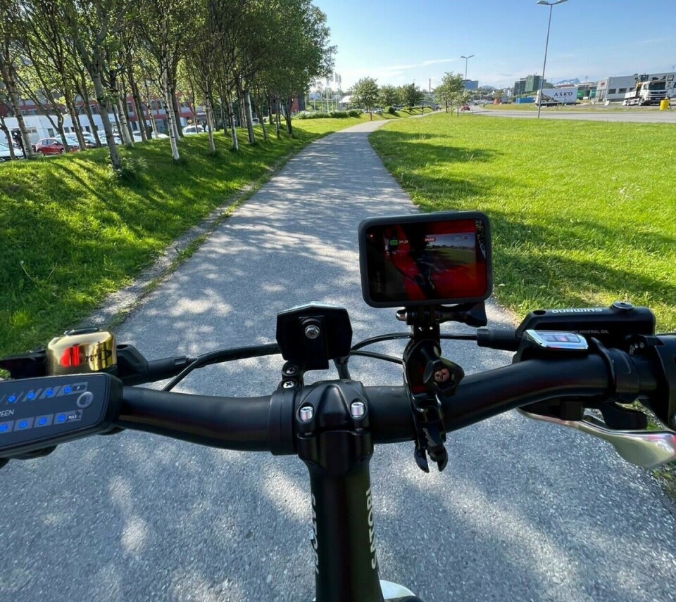
Using a GoPro camera, she developed a systematic method to map road systems. The method was inspired by how autonomous vehicles collect and analyse data about their surroundings.
Her approach was as simple as it was effective:
- With a GoPro camera mounted on her bike, she cycled through the streets of Bodø.
- Along the way, she systematically recorded everything from the quality of the road surface to dangerous intersections and sudden changes in bike lane design.
“I used the same logic as the self-driving buses. They continuously gather data to navigate safely. I thought: Why not use the same systematic approach to make roads safer for cyclists?” she says.
All the information was then entered into a system, creating a digital map that highlighted areas in need of improvement and those that worked well.
“It’s about identifying patterns. Where are the critical points? Where do dangerous situations occur? With this method, we get a solid data foundation to make better decisions,” says Kolesnikova.
Improvements for pedestrians and cyclists
The method caught the attention of the Norwegian Public Roads Administration.
Her findings became a part of the foundation for evaluating measures to improve conditions for pedestrians and cyclists in Bodø.
“After presenting the findings to the Bodø City Package board, two million NOK was allocated to implement measures,” says Kolesnikova
She also sees interest in the method from other parts of the country:
“I am in dialogue with the Norwegian Public Roads Administration and Innlandet County Municipality. They plan to adopt the method and require guidance.”
"A valuable tool"
Ole Wiggo Nerva confirms the interest. He works at the Norwegian Public Roads Administration, Bodø City Package.
“The methodology of using filming and images provides a good impression of specific points to assess complexity and opportunities for improvement,” he says.
He explains that a working group from Bodø Municipality, Nordland County Municipality, and the Norwegian Public Roads Administration used the data to prioritise measures and assess costs.
“This is a valuable tool that offers an overview of measures that can be implemented. The same methodology can be used in other municipalities aiming to improve school routes, cycling infrastructure, and traffic safety,” he says.
What started as a project inspired by self-driving buses may now contribute to making Norwegian roads safer in other parts of the country as well.
After completing her master’s degree, Kolesnikova worked at the Norwegian Public Roads Administration for a period of time. She is now a trainee at Nordland County Municipality, helping connect Northern Norway to the world.
She has landed what she describes as her dream job.
“All of this is thanks to EduSmart,” she says.
“I’ve never had so much fun at work, even with all the traveling. I feel like I have everything in this role. Now I can use all the knowledge I’ve gained.”
To other students, she offers a piece of advice:
“Get involved in activities outside of your studies. Participate in projects. Volunteer at conferences. It pays off!”
———
Read the Norwegian version of this article on forskning.no

This content is paid for and presented by Nord University
This content is created by Nord University's communication staff, who use this platform to communicate science and share results from research with the public. Nord University is one of more than 80 owners of ScienceNorway.no. Read more here.
More content from Nord University:
-
This unique picture book features two Indigenous languages and English
-
Ukrainians forced from their homes: "They lost everything, then started new businesses”
-
Kateryna's university has been bombed three times – but she's still teaching
-
5 things you didn't know about smart cities in the Arctic
-
These algae have been adapting for hundreds of millions of years
-
Could traces of bacteria in water combat salmon disease?


