Detecting avalanches with satellite radar
Satellite imagery that can penetrate fog, darkness and storms to detect old and recent avalanche tracks has the potential to help improve avalanche forecasting across Europe.
The mountains of the world are seeing an increasing number of eager skiers, snowboarders and snowmobile enthusiasts who take to steep snowy backcountry slopes for fun.
That fun has a dark side, however, in the form of greater exposure to avalanches, which kill an estimated 250 people worldwide per year.
Avalanche researchers in Norway are now looking into using satellite imagery as a tool to improve their ability to improve avalanche forecasting and warnings.
Rough surfaces visible
“We have recently realized that it is possible to see avalanches with satellite-based radar,” says Markus Eckerstorfer, a research scientist at Norut Northern Research Institute in Tromsø.
The satellite radar sends pulses of electromagnetic radiation to the ground. Part of this radiation is reflected and sent back to the radar, he explains.
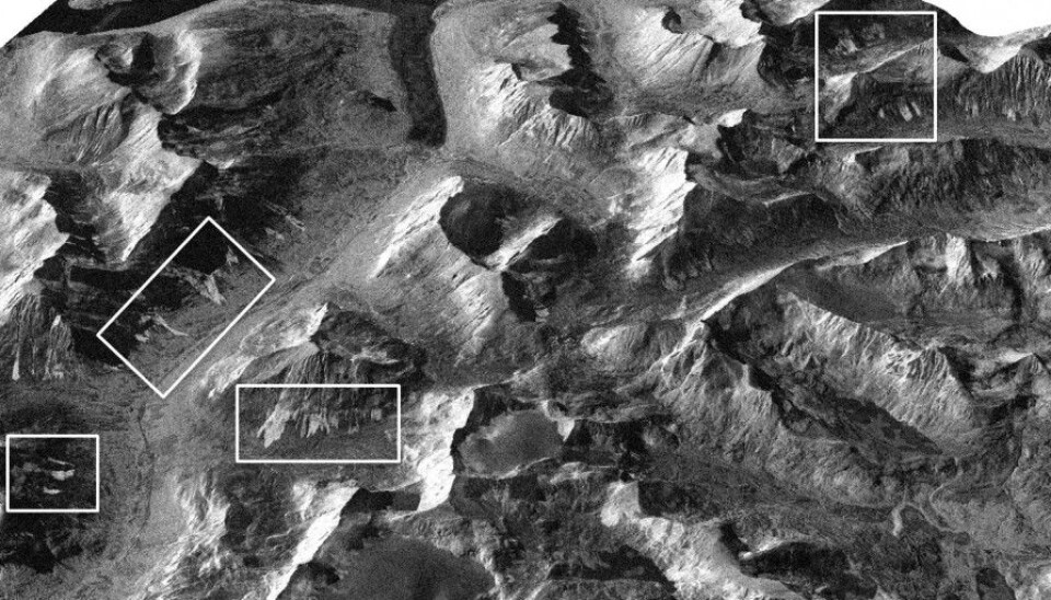
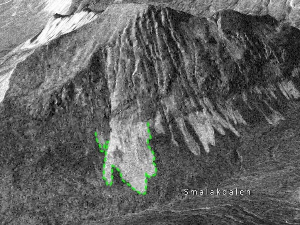
“Generally, snow doesn’t reflect much of this radar signal back, but avalanches really light up on radar images,” he said.
Usually, snow presents a fairly smooth surface to the radar signal, but avalanches destroy this surface, leaving in its place big jumbled heaps of snow.
“We're not quite sure why avalanches are so visible, but we think it is due to their rough surface. We only see this area in the image, since the surface of the regular snowpack is smooth,” Eckerstorfer said.
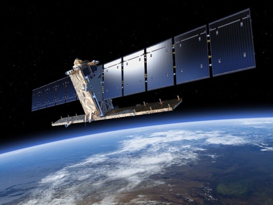
In addition to giving researchers the ability to look at large areas from the sky, satellite radar works independently of storms, fog, night or other conditions that would normally prevent the capturing of images from conventional satellite cameras.
European Space Agency satellites
The Norut researchers are now using the European Space Agency’s Sentinel-1A satellite to investigate avalanches in Norway. Eckerstorfer recently published a paper in Cold Regions Science and Technology that explains the approach using a different satellite owned by Canada.
The article describes how researchers found traces of nearly 500 potential avalanches in a small mountainous area of Troms County in northern Norway.
At the time, the scientists had to go through the images manually to record all the avalanches. They are now trying to automate the process by creating a computer algorithm that combs through the radar images and automatically finds potential avalanches.
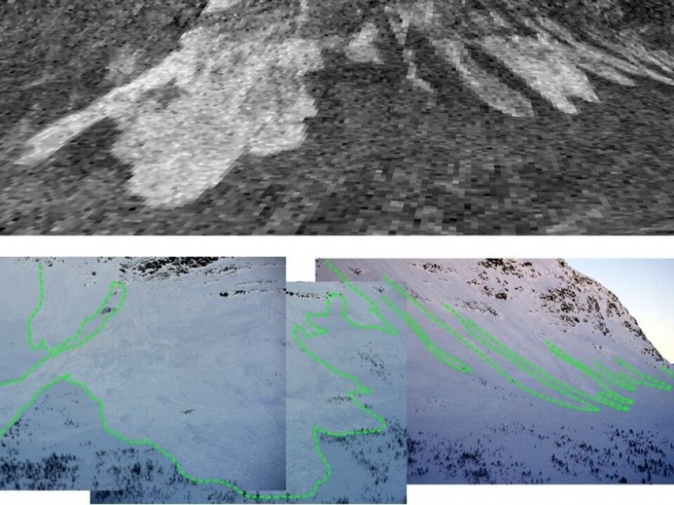
Eckerstorfer says the algorithm can now detect around 90 per cent of the avalanches in the images. But the researchers also need to make sure that the avalanches they detect in the images are actual avalanches in the real world. They do this by comparing the radar images of the suspected avalanches with actual photos of the places where the radar imagery suggests there has been an avalanche.
“We work with remote observations of avalanches, so there will always be uncertainties in the findings,” he pointed out.
Improving Norwegian, European avalanche warnings
Norway’s avalanche warnings are created by a small team of experts who collect weather and snow data and combine that with snow reports from around Norway. The warnings are published on varsom.no.
“I think avalanche warnings could be more precise if we could use radar images,” said Rune Engeset, a section chief and head of avalanche forecasting at the Norwegian Water Resources and Energy Directorate, which is responsible for varsom.no.
“When we create avalanche warnings, what we are doing is making our best guess about the probability that there will be an avalanche. The radar images offer us a way to check how good our warnings are,” he said.
Engeset understands that the system has some limitations, but he thinks it has great potential.
“We need to work together to find out which kinds of avalanches can either be detected or not detected,” he said.
For his part, Eckerstorfer thinks this method could be used to create a database for avalanches throughout Europe.
“The challenge is that we would collect massive amounts of data, so the system must be automated to work,” he said.
He envisions an automated database that can also store meteorological measurements for avalanche areas, so that the number of avalanches can be related to the weather conditions in the area when the avalanches happened.
-------------------------------------
Read the Norwegian version of this article at forskning.no


